


 39 / 72

FOCUS
Money matters and financial services
Special
Satellite imagery:
Farming for the future
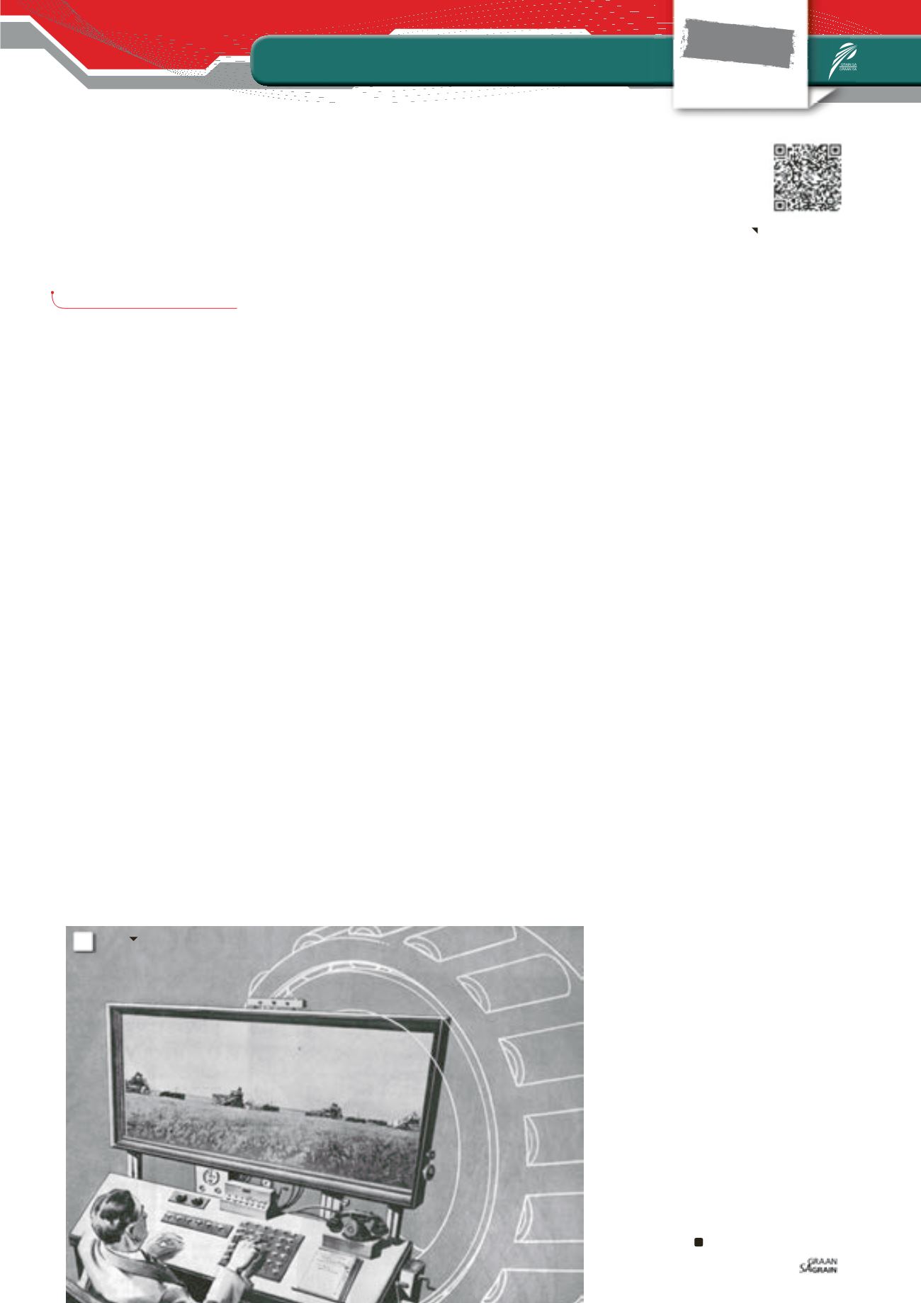
I
n 1931 American mechanisation com-
pany Timken published an advert in
The
Country Gentleman
with a picture
of a ‘producer of the future’ in 2031
managing his lands from his big screen TV
(
Photo 1
).
Published decades before the advent of
the computer, this image aspired to the
first generation of producers using tractors
who at that time didn’t have electrictiy on
their farms. 85 years later and the vision of
the producer of the future hasn’t changed
much. What has changed is the tools avail-
able to producers to achieve this vision.
In the past 100 years agriculture has gone
through a number of technological revolu-
tions that have seen the industry producing
more with less. These include: The Green
Revolution, the Precision Agricultural Revo-
lution and most recently the Data for Ag-
riculture Revolution. Each of these where
driven by a global need to feed a growing
population with fewer resources and have
been powered by global advancements in
the latest science and technology.
The Green Revolution, whichwas focused on
improved crop genetics, allowed producers
to increase both hectares and yields in less
favourable climatic conditions. The Green
Revolution was largely enabled by global ad-
vancements in medical scientific discoveries
in the medical field centred on the cellular
genome. The Precision Agricultural Revolu-
tion, which was almost entirely focused on
advanced mechanisation, allowed produc-
ers to manage large volumes of hectares
with less manual manpower. This Precision
Agricultural Revolution was largely pow-
ered by advancements in military GPS
technology, allowing for the remote control
advanced mechanical tractors and tools.
The Data for Agricultural Revolution, which
in many ways was a natural extension of
precision farming, is focused on the remote
collection of high value data sets that allow
the producer to gain more in-depth insight
of the actual situation of his crop on a per
field, per hectare basis. This revolution is
currently being powered by simultaneous
developments in the IT and aerial surveil-
lance industries.
Satellite imagery, a vision
of today
Just a few years ago the thought of solving
complex agricultural challenges through
high resolution imagery on a grand scale of
hundreds and thousands of hectares was
simply unachievable.
Not because the science of remote sensing
was underdeveloped and did not exist, but
due to the cost and lack of commercial mar-
ket access to relevant technological solu-
tions needed to achieve this goal. Although
satellite imagery has been available (in a
limited format) to the agricultural industry
for decades, it has been costly and untime-
ly, lacking the ability to provide producers
with a solution that helps them make day to
day decisions on their fields.
In 2002 when South African born Elon
Musk established SpaceX, a company
aimed at building reusable commercial
space rockets that could carry cargo to and
from space, the average producer couldn’t
even begin to fathom how space would
play such a critical role in his day to day life.
More than a decade later space has become
the prominent environment for technology
development in the management of activi-
ties such as navigation, climate monitoring,
and agriculture production here on earth.
Today there are more than a dozen com-
mercial companies all competing in a new
field of satellite imagery that form part of
what is called ‘agile space’. Agile space aims
to provide more regular, high resolution
coverage of the globe that will enable pro-
ducers and those in other industries to gain
insight into solving today’s problems, not
yesterday’s, with the aim to making timely
decisions that will have an impact on yields
for tomorrow.
AgriSig™ is an agricultural technology com-
pany that specialises in the delivery of a
wide range of high value remote sensing
and risk mitigation products to the agricul-
tural market. We have teamed up with the
world’s most advanced satellite service
providers who today have the most fre-
quent satellite coverage of Southern Africa.
Our high-resolution (3 m to 5 m) imagery is
downloadable merely eight hours after be-
ing captured by the satellites and can be
delivered to our clients within two days of
capture. Our products are specifically tai-
lored to your needs and are charged on a
per hectare basis of arable crop.
Our new satellite products allow you to gain
both visual and analytical insight over all of
your fields throughout the critical growth
phases. We provide you with a high-resolu-
tion visual image, a zoned normalised differ-
ence vegetation index (NDVI) which shows
you your exact areas of variation on a per
hectare basis.
We provide you with geo-referenced in-
spection points per zone in order to estab-
lish the exact cause of variation in real time,
for the development of precision application
maps that allow you to take action when it
really matters.
37
May 2016
Product information
CHANTAL YAZBEK,
AgriSig
1: The producer of the year 2031 works at his large flat-panel television
(image generated in 1931).
1
Read more on the
producer of 2031.