


 28 / 116

Oktober 2018
26
Ultra-precision ground truthing of
soil properties now a
reality
I
t is very important to conserve soil and
water resources in South Africa, since
there is no new land available for culti
vation and also no new water resources
to use for irrigation. Conservation through
precision agriculture technology is the
key to sustainable use of our natural re
sources.
Site specific management, also named
precision agriculture, started off based on
a single farm in the old days, then produc
ers started to differentiate between fields,
followed by zoning within fields. Grid sam
pling, where one sample is taken per 1 ha
to 4 ha is the current method for identify
ing such management zones. The challenge
thus lies in moving towards site specific soil
and water management of every square me
tre, named ultra-precision.
For ultra-precision to be a success, a large
amount of affordable, accurate and qual
ity information about the possible limiting
spatial soil variability is needed. A very
popular way to go about characterising the
variability of soil and to produce high reso
lution, good quality maps is by using bulk
apparent soil electrical conductivity (ECa)
sensors. Non-contact proximal ECa sensors
are based on the principle of electromag
netic induction (EMI).
Sensor function
An EMI sensor consists of a transmitting
coil at one end of the instrument that in
duces a circular eddy-current into the soil.
Each current loop generates a secondary
EM field proportional in value to the current
flowing in the loop. The receiver coil on the
other end of the EM instrument intercepts
a fraction of the secondary field from every
loop and the sum of the signals heightens
and forms an output voltage related to ECa
(Corwin and Lesch, 2005).
The most common EM instruments used in
agriculture include the Geonics EM31 and
EM38. The EM38 sensor is portable and
designed to measure soils of the root zone.
This area is typically to a depth of 750 mm
when held in the horizontal (EMH) operation
mode.
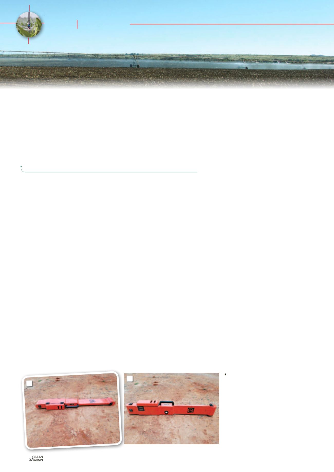
When placed in the vertical (EMV) position
the EM38 takes readings at about 1 500 mm
(
Photo 1a
and
Photo 1b
). The EM31 sensor
measures at soil depths up to 6 m and is of
ten used in characterising the presence of
shallow water tables or salts in the vadose
zone (Corwin
et al
., 2003a; Amezketa, 2007;
Corwin and Lesch, 2005).
Anywhere from 100 to thousands of spatial
ECa measurements can be taken with a mo
bile unit that takes continuous soil measure
ments (
Photo 2
). With the addition of a GPS
system, measurements can be pin-pointed
with 1 cm accuracy. Advantages of EMI in
clude speed, ease, relatively low costs and
large volumes of data collected.
ECa measurements
An EMI sensor measures the changes in
the apparent electrical conductivity which
is an average measurement for a column of
soil to a specific depth. In reality the sen
sor does not measure just one soil variable
but responds to many, because various soil
properties influence the conductivity of a
soil.
Variations in ECa are thus due to the influ
ence of the combined conductances of
many physical and chemical soil properties.
Direct properties include the concentration
and type of ion in the soil solution, water
content, type and amount of clays, soil tem
perature and soil water.
Indirect factors that influence ECa include
bulk density, ionic composition, soil struc
ture, pH, cation exchange capacity, soil
organic carbon, calcium carbonate and nu
trient levels.
Focus
Irrigation
Diandra Steenekamp,
head, Department QGIS,
Lindi Smit,
directing manager and
Roelof Smit,
head of marketing, Van's Lab
1a and 1b: EM38 in
a) horizontal positions
providing measure-
ments to 750 mm and
b) vertical orientation
measuring up to
1 500 mm.
1b
1a
Grain SA/Sasol photo competition