


 51 / 92

49
November 2015
water source, for instance the maximum consented water volume or
flow rate.
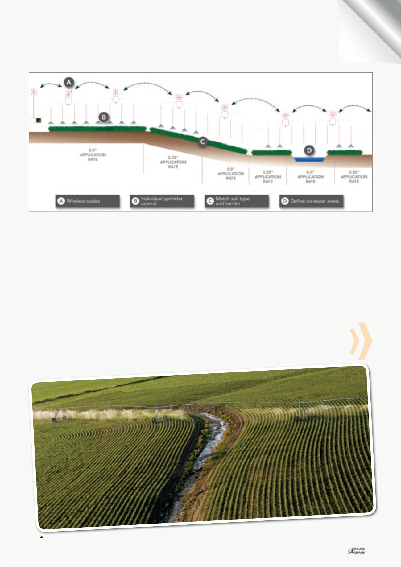
Field information relating to the irrigated area can be defined by
aerial photographs, electromagnetic survey maps, available water
holding capacity maps, crop parameters, infrared image maps, and
polygons exported from Google Earth™ and user-defined GPS in-
formation. User-defined GPS information often identifies avoidance
areas such as races/tracks, ponds, troughs, specific paddocks or
unproductive areas. As field information is constructed in “layers”,
many different types of field information may be considered when
creating irrigation plans.
Within the map, “management zones” are set from the field informa-
tion in which different application rates are applied. As the preci-
sion variable rate irrigation system allows individual control of every
sprinkler along an irrigator, there are no spatial or profile limitations
to the management zones.
Precision variable rate irrigation plans can be either manually im-
ported into the precision variable rate irrigation controller or trans-
mitted wirelessly. Once the plan is loaded onto the variable rate
irrigation controller, it is ready to apply. The variable rate irrigation
controller reads the plan and sends a message to wireless nodes
along the length of the pivot. Nodes control each individual sprinkler
to turn on or off, or pulsate according to field position and desired
application rate. Each sprinkler is controlled by a magnetic latching
solenoid valve that’s built to last.
The precision variable rate irrigation system has several operation
modes, one of which allows you to set irrigation depths (e.g. 10 mm,
5 m and 8,5 mm) on your map and then the variable rate irrigation
controller takes care of the rest, pulsing valves and controlling the
speed of the irrigator towers accordingly. Another option allows you
to set percentages. You can set areas to receive any amount from
0% - 100%.
Figure 2: The modular Growsmart precision variable rate irrigation system – the main controller communicates wirelessly to nodes which are mounted
along the length of the irrigator. The nodes individually control each sprinkler.
Why waste water irrigating a water-way when you do not need to with Growsmart precision variable rate irrigation?